|
Cycle Paths, Australia |
Cycle Paths, Australia
Below are details of the Cycle Path,
From the Mountains |
To the Murray |
Rail Trail |
and further below are links to the Albury Wodonga Cycle Paths,
and the Wangaratta Cycle Paths.
This display section of the Cycle Path is from Tarrawingee Station to Everton Station, a Rail Trail of approximately 10 Kilometres, fairly flat for very easy cycling.
Tarrawingee Station to Everton Station, 10 Km |
 |
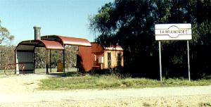 |
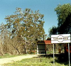
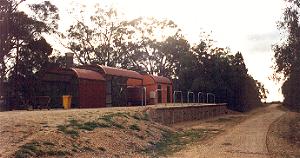
Above are photos of the Tarrawingee Station with the famous Federation Tree in the background of the above left hand photo. The Station is designed in the shape of an old steam engine.The station has excellent toilet facilities, good shade and cover for resting, lunches or picnics, and usually has tank water collected from the roof. The safest bet though is to carry your own drinks.
 |
 |
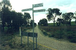
The cycle Path from Tarrawingee Station to Everton Station is fairly flat, and easy riding for any age cyclist. Standing on the Beechworth Wangaratta Road, you see the cycle path stretching back to Tarrawingee rising up a slight incline, above left. The three road signs say, " Beechworth Wangaratta Rd.," "21 Wangaratta," "Beechworth 16."
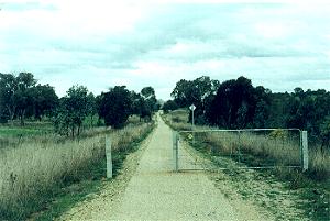
Straight across the road is the cycle path to the Everton Station, Photo above right. The Station is at the end of this path and to the left.
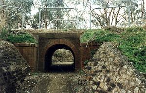 |
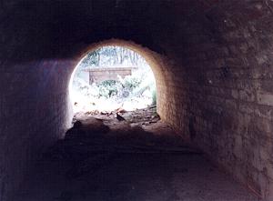
Crossing underneath the cycle path at the Beechworth Wangaratta Road is a culvert or drain. This beautifully made red brick "mini bridge" was built by the railway workers when first laying the train track from Wangaratta to Bright in the late 1800's, to allow the drain to cross under the train track.
 |
 |
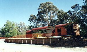
Above is a photo of the Everton Station, also built to the same steam train design. It was here at Everton Station that the line forked, with one line going to Beechworth, and the other to Myrtleford and Bright.
 |
 |
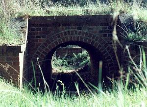
In the above photos you can see two more of these amazing red brick "mini bridges" located between the Everton Station and Boundary Road. They are about 150 metres south of the station. This is where the actual train lines forked in the 1800's, and this culvert or drain runs under both train tracks under these two identical mini bridges. You can see above looking through one culvert you can see the other Mini Bridge.
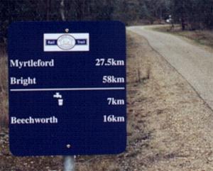 |
Leaving Everton Station and heading towards Bright, you come to a sign, photo above. This sign informs you that Myrtleford is 27.5 km, and Bright 58km. Also there is water available in 7km on the Beechworth branch, and Beechworth is 16km.
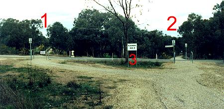 |
On leaving Everton Station and heading towards Bright, you come to Boundary Road, photo above. A sign ( 3 ) indicates that Beechworth is to the left ( 1 ) and that the Bright Cycle Path is to the right ( 2 ).
|
Tarrawingee Station to Everton Station, 10 Km |
Links to the Mountains to the Murray Bicycle Rail Trail |
| Bright to Porepunkah | Porepunkah to Myrtleford | Myrtleford to Everton |
| Everton Stn to Beechworth | Everton to Wangaratta | Wangaratta Bike Paths |
The Up Button will take you to the Home Page