Reform Hill Walk
Page 2
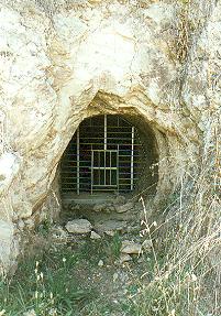 |
Above is a photo of one of the mine entrance tunnels which is located near the Rail Trail opposite the Old Butter Factory.
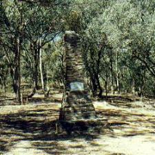
To commence the walk, pass through the entrance gate and proceed along the path. Shortly you will come to a monument built in November 1924 to honour the achievements of the Explorers Hume and Hovell who passed this point 100 years before.
 |
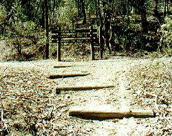 |
Above left is the Monument to Hume and Hovell. Above right is the T Intersection.
Walk along the track past the Hume and Hovell Monument and shortly you will come to a T Intersection. At this point the track divides into two, and the left hand track is known as the Gully Track, whilst the right hand track is known as the Ridge Track or Spur Track. Both tracks meet again just below the Lookout. As you can see above the track is well signposted.
Spur Track
The track to the right is the Spur Track, which is the steeper of the two tracks. This will take you past an old ventilation shaft which once serviced the Reform Mine. It is now carefully encased in concrete, and has a grill metal safety sheet securely attached over the top.
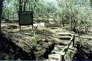 |
Above you can see the walk to the Ventilation Shaft, and on the left is an information board showing some details and statistics from the mine.
Continue along the track, where you can see mullock heaps and several shallow surface diggings. Many wildflowers may be seen during the warmer months including grevilleas, peaflowers and orchids. Fauna possibly encountered includes Eastern grey Kangaroos, Echidnas and many birds such as Flame Robins, Pardalotes and Gang-Gang Cockatoos.
The track turns to the north and heads uphill, quite a steep section. It joins the Gully Track just below the lookout.
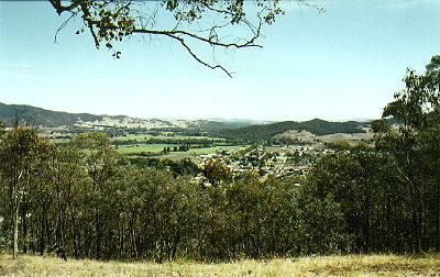 |
The magnificent view over the township from the Reform Hill Lookout.
Gully Track
This track follows the drier northerly aspect of Reform Hill and the vegetation changes. Red Stringybark, Red Box and some Peppermints can be seen. Areas of tussock grass and Austral Grass Trees are common. All of the forest vegetation seen along the walks is regrowth, as the hill was cleared during mining days to provide fuel and building materials.
Nearing the monument you will see the town's old water storage basin. Long since abandoned this small reservoir used to hold water run off from the hill.
|
|
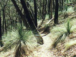
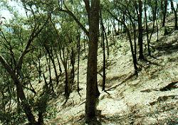
Above left the Austral Grass Trees, and right, the Gully Track winding down the hill.
The Up Button will take you to the Home Page