YACKANDANDAH GORGE |
| Drive | Walk |
 |
DRIVE TOUR
Approximately a 5 kilometre trip.
Time approximately 15 minutes.
At the top of High Street, Yackandandah, turn right into Bells Flat Road, and continue approximately 700 metres after the bitumen turns to a gravel road. You will see the Car Park on the left hand side of the road. Park here. The sign posts will give you a brief history and some basic directions.
The gorge is a short walk along the paths.
Follow the paths, the one to the right to see the begining of the gorge, after crossing a stye over a fence to do so.
The left hand path takes you to the bridge over the creek which is the end of the race or gorge. There is a path which connects the bridge to the start of the gorge, which is on the car park side of the creek, and there are walking tracks over the bridge, taking you to the wall of stone, the start of the gorge, and all the way back to Yackandandah.
WALKING TOUR
Approximately a 4 kilometre walk
Approximately 35 minutes walking
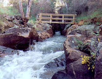
Commencing from the Yackandandah Post Office, cross High Street and head south along Wellsford Street, crossing Windham Street, over Yackandandah Creek, walking past the tennis courts and the cricket ground, following the path until you again meet the Yackandandah Creek at the wooden bridge shown below. You are now at the end of the water race.
To proceed home you may either retrace your steps, or follow the paths on the western side of the Creek to the car park 300 metres above. Head north along the gravel road, being Bells Flat Road. The gravel turns to bitumen approximately 700 metres along, following this you will see the cricket ground and sports complex to your right, turn or veer right into Windham Street which will take you back to Wellsford Street, from whence you should be able to see the Post Office up the hill.
 |
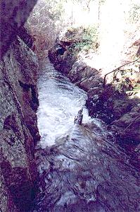
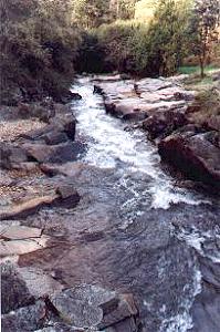
The above photo is taken at the commencement of the gorge or diversion, just below the concrete wall.
|
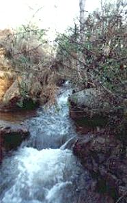 |
Above left is a photo from around the middle of the gorge looking downstream, or north, and on the right from nearly the same section looking upstream.
 |
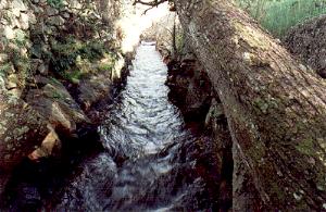
The stream passes under the footbridge, leaving the gorge, and heads towards Yackandandah. The walking track is on the right hand, or the eastern side.
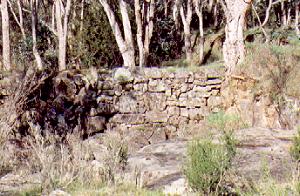 |
Above is a photo of the brick retaining wall, found about 200 metres to the south east of the footbridge. This wall was built also in an attempt to divert the creek for gold mining purposes.
Yackandandah Attractions |
| Town Walk | Lions Walk | Gorge Walk |
| Town Drive | Allans Flat Drive | Forest Drive |
| Museums | Court House | Mineral Springs |
YACKANDANDAH'S |
For more information on Yackandandah Tourist Attractions please call the Information Centre on 0260 271 988 |
The Up Button takes you to the Home Page.