Camping Areas
There are many camping areas along the Victorian bank of the Murray River. Below there is a map showing the major three sites. There are no amenities at these sites. There are sign posts to explain the rubbish collection points and the basic rules of camping.
Doolans bend is located on the Banks of the Murray near Gehrigs Winery at Barnawartha. Travelling from Wodonga the Murray Valley Highway and the Howlong or River Road intersect virtually at Gehrigs Winery. Turn right into the River Road and approximately 2 Km along there is a small sign on the right or river side saying Doolans Bend.
|
|
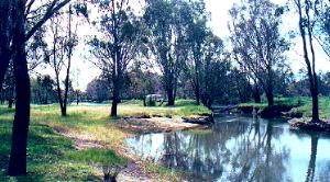
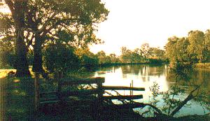
Above is a photo of the small stream or annabranch of the Murray River which runs through the Camping Reserve. This makes an ideal boat launching place as the stream runs straight into the Murray, which you may be able to see on the middle left of the photo. Above right is the large sweep of Doolans Bend taken at dusk. The fishing here is quite good.
The Police Paddocks Camping Reserve is at the river end of Police Paddocks Road. Travelling from Rutherglen past All Saints and St Leonards Wineries along the Up River Road, drive for approximately 7Km. Turn left into Police Paddocks Road, and head towards the river. The road ends in a farm property, but at the farm "gate" there is a notice No River Access, Private Property. Here you will need to turn left into a small road that goes into the reserve. This reserve is about 1 Km long.
The Police Paddocks is actually an Island of 100 acres used to spell the police horses in the 1880's. It was connected to the mainland by a private bridge over Murphys Creek which is an annabranch of the Murray River. It is now part of the Gooramadda State Forest.
 |
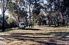 |
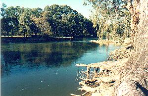
Above left is a photo looking over the river to the Police Paddocks, and the remains of the old bridge. Above right is a photo of the camping area.
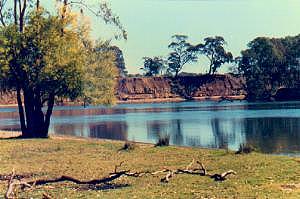
Stantons Bend is a camping reserve near Lake Moodemere. Coming from Rutherglen along the Murray Valley Highway, pass Campbells Wines, pass Bullers Winery turnoff, ( Three Chain Road ) and turn right into Moodemere Road. The road is a bitumen road to the turnoff to Lake Moodemere. Keep on Moodemere Road and follow the dirt road right to the end, where it turns right and goes through the entrance gate to Stantons Bend.
 |
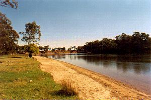 |
As you can see above Stantons Bend is a stunning section of the Murray River where the river runs wide and straight towards the cliffs at the end, and then turns sharply to the right. Because the river is wide, the currents are not as strong as at say Police Paddocks, making swimming here much more attractive.
There is plenty of camping space, but again no facilities. Please follow the signposted rules for camping and tidy up before you leave. There are rubbish collection points here.
For more Information on Rutherglen Camping Grounds please phone the Rutherglen Tourist Information Centre on 0260 336 300
RUTHERGLEN'S |
The Up Button will take you back to the Home Page.